Landslide 3D groundwater evaluation and countermeasure services
- Field
- Keyword
Overview
Landslides are inherently events occurring in three dimensions, for example, the geological structure of the entire landslide site, the complex shape of the slip surface, and the distribution of groundwater. However, it had been normal to conduct two-dimensional analysis and investigation of countermeasures based on the results of boring surveys, etc. This made it difficult to quantitatively estimate and predict the effect of countermeasures in two-dimensional surveys and studies, and difficult to plan the arrangement of economical countermeasures based on the predicted effects.
In response, OYO Corporation has developed a highly-efficient and highly-effective new technology for examining landslide countermeasures. This technology uses 3D geotechnical analysis technology to visualize the geological structure and groundwater distribution of the entire landslide site in 3D.
Features
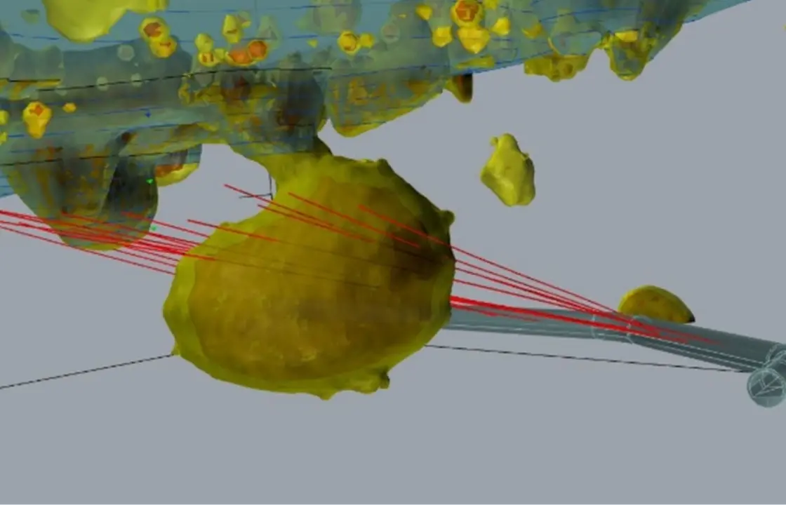
Application of 3D geophysical exploration
3D geophysical exploration does not consist of 2D survey results of 3D images. Instead, it is a technology that directly measures and visualizes the 3D spatial distribution of ground physical property values. We propose the following two methods for groundwater countermeasures against landslides.
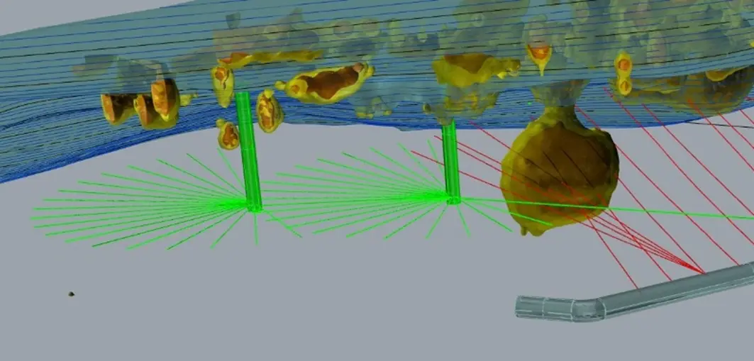
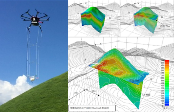
Drone airborne electromagnetic survey
Drones are capable of quickly surveying wide areas. Therefore, drones are effective for landslide / erosion control projects in mountainous areas or over a wide area, the application of drones. The drones visualize the 3D resistivity structure of the ground using the electromagnetic response of electromagnetic waves which are artificially incident on the ground.
Applicable depth: 100 to 200 meters
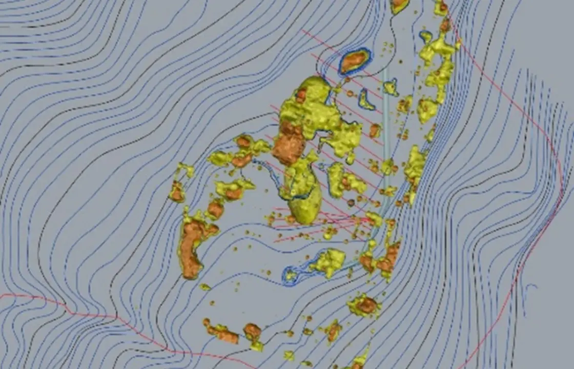
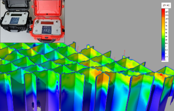
3D electrical exploration
The FullWaver system measures detailed resistivity distribution at medium depths in 3D. Through preliminary exploration for countermeasures work, we predict the effects of countermeasures in advance and select the type / scale of countermeasures. Through exploration after countermeasures work, we will verify the effects of countermeasures, such as changes in groundwater.
Applicable depth: 30 to 50 meters
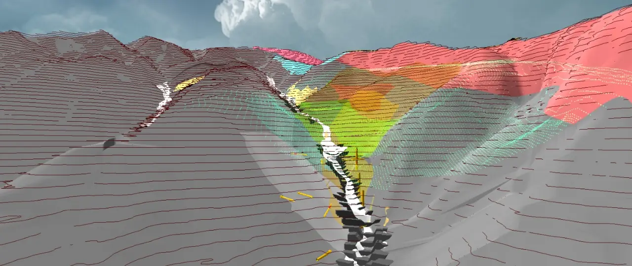
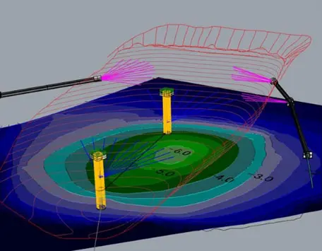
Proposal of effective countermeasures using 3D seepage flow analysis
We model the entire landslide in 3D, and we visualize and analyze groundwater behavior in 3D. As a result, it is possible to estimate the effects of individual countermeasures, such as drainage tunnels and catchment wells, and to evaluate the combined effects of integrating each countermeasure. It is possible to quantify the effect of countermeasures, which was difficult in 2D examination, and to consider the economic arrangement of countermeasures.

Use of 3D technology to verify the effectiveness of countermeasures
We perform 3D electrical exploration before and after construction of groundwater countermeasures, and perform difference analysis to visualize the effective range of groundwater countermeasures. This makes it possible to study the validity of countermeasures, and to study the necessity of additional countermeasures and the optimal construction position.