Construction / city development field20230403
Geological and geotechnical risk management

Field:
Infrastructure Maintenance, Management, and Renovation > Construction / city development field
Keyword:
Overview
"Geological and geotechnical risk" refers to the invisible "uncertainties" inside the ground that may cause cave-ins, sinkhole accidents, ground subsidence, etc., during underground
excavation and other similar work.
Through 3D visualization of geotechnical and geological structures, 3D geological analysis technology is a solution for reducing uncertainty and preventing accidents and disasters
caused by geological and ground factors.
OYO Group proposes geological and geotechnical risk management with the aim of increasing productivity throughout the entire construction and production process. Specifically, we
engage in measures such as extracting geological and ground risks from the business planning stage, promoting risk communication from the stages of survey, design, construction, and
maintenance management, optimizing business costs, and preventing construction delays.
Features
Geological risk management provided by the OYO Corporation
Preliminary risk assumptions and management methods proposals based on geological expertise
We evaluate the terrain and geology of candidate sites from the business planning stage, and propose the necessary risk communication methods and management plans.

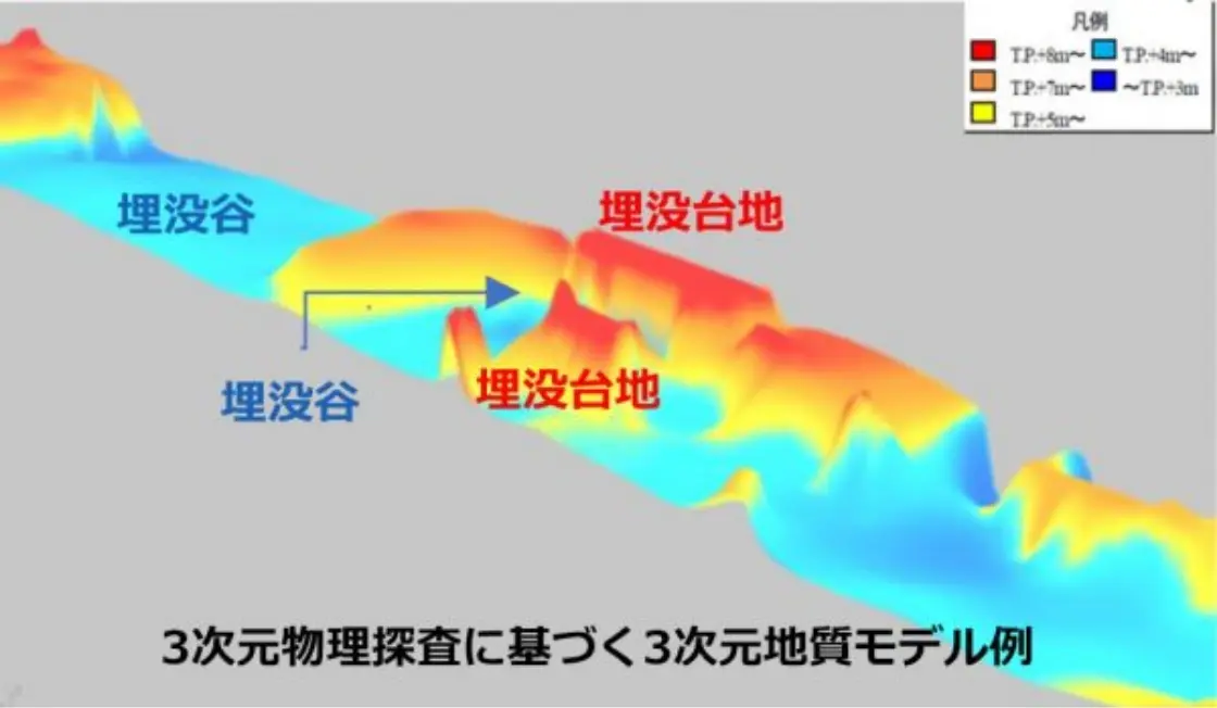
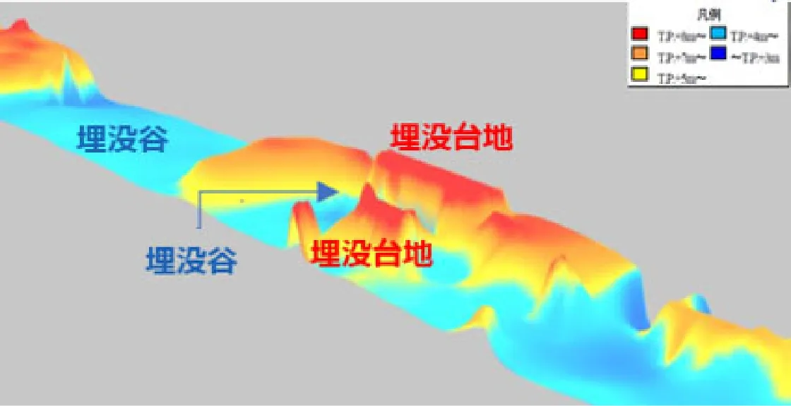
Using 3D technology to visualize geological risk, also linked to BIM / CIM
Using the latest 3D geotechnical analysis technology to visualize hidden geological and geotechnical risks. We propose appropriate countermeasures that are neither excessive nor deficient. We also link our technology with BIM / CIM for building 3D geological models.
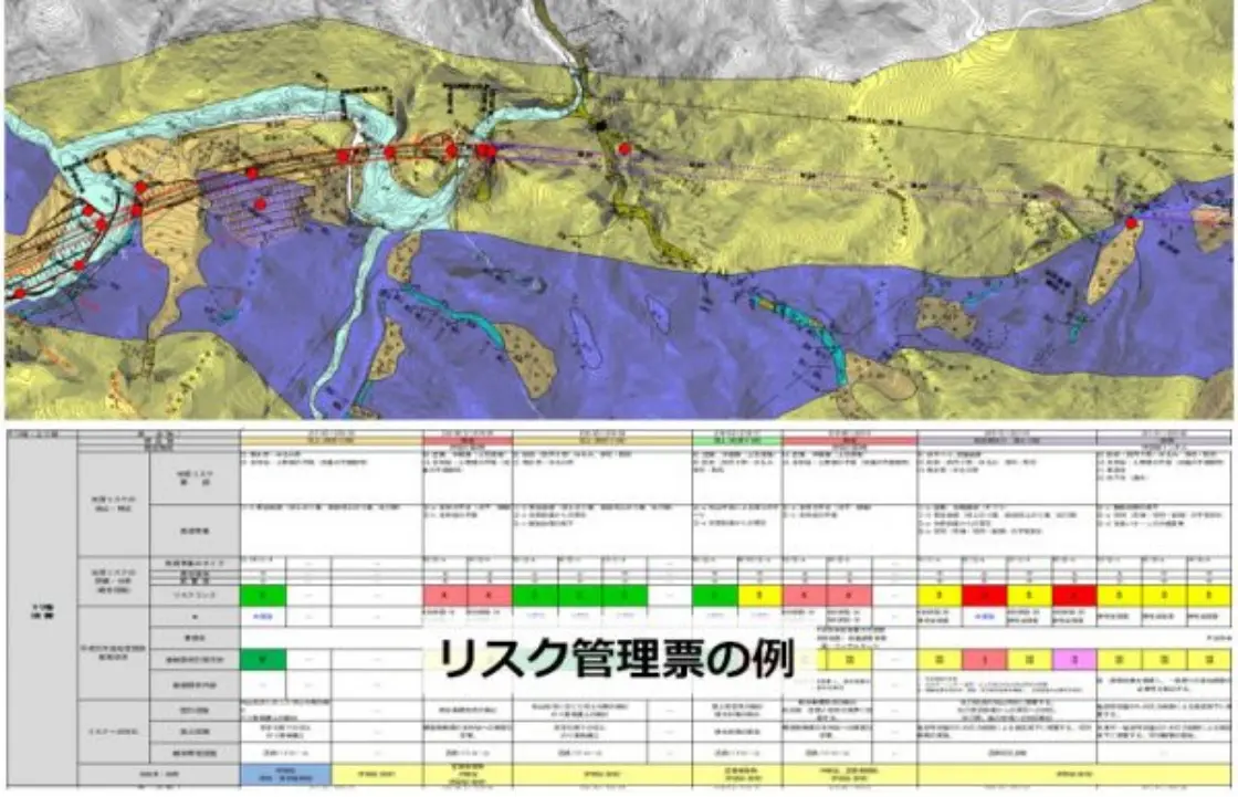
Creation of a management chart that assumes multifaceted risks. Proposals for monitoring
Based on the assumed geological features, we organize risks that may occur in the succession process and methods for dealing with those risks. If there is residual risk, we propose appropriate monitoring methods.
By having expert geological engineers extract geological risks at the applicable site from the initial phase of business planning, OYO Group is able to increase productivity throughout the entire construction and production process. Specifically, we enable smooth risk communication from the stages of survey, design, construction, and maintenance management, optimization of business costs, and prevention of construction delays.
3D geotechnical analysis technology that can be linked to BIM / CIM
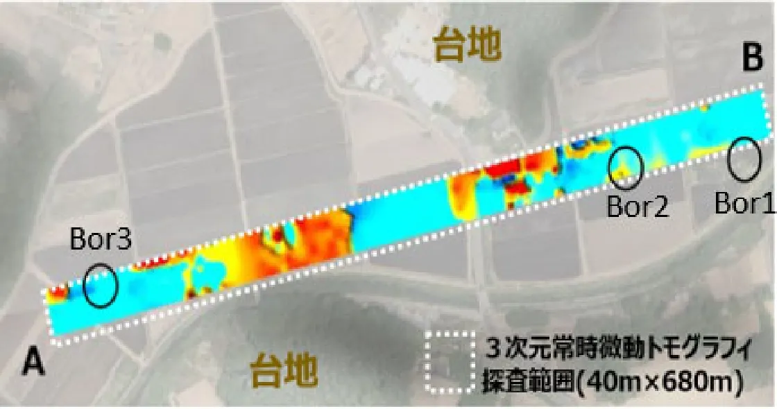
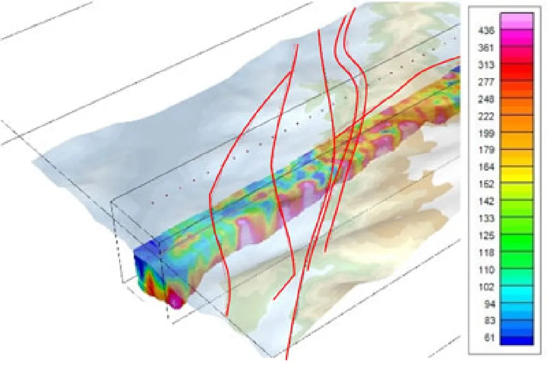
Example of bypass construction project
Exploration results of 3D microtremor array survey (bird's-eye view)
Representation of the alluvium bottom surface
Elevation contour of the alluvium bottom face
Example of tunnel business
Use of airborne electromagnetic survey method to integrate of 3D resistivity model of planned tunnel routes and faults from the previous literature
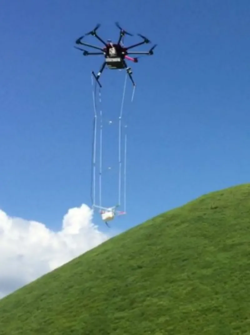
3D airborne electromagnetic survey
Achievements
| Fiscal Year | Orderer | Subject |
|---|---|---|
| 2016 |
Kinki Regional Development Bureau
Kinan River National Highway Office |
Susami Kushimoto Road and other geological risk studies in the eastern district |
| 2017 |
Hokkaido Regional Development Bureau Otaru Development and Construction Department |
National Route 5 Formulation of geological survey plan for outside Kutchan Town |
| 2018 |
Minister's Secretariat Technical Research Division |
FY2018 Surveying and studies for establishing technical methods for geological and geotechnical risk management |
| 2018 |
Kinki Regional Development Bureau Kinki Technical Office |
Creation of basic materials related to geological risk management |
| 2018 |
Shikoku Regional Development Bureau Nakamura River National Highway Office |
Geological survey work for surface of Saga Ogata Road |
| 2019 |
Shikoku Regional Development Bureau Nakamura River National Highway Office |
FY2019 Surveying and studies for geological risks outside of Saga Ogata Road |
| 2019 |
Kinki Regional Development Bureau Kinki Technical Office |
Revision of manuals on geological risk management |
| 2019 |
Minister's Secretariat Technical Research Division |
FY2019 Surveying and studies for establishing technical methods for geological and geotechnical risk management |
| 2019 |
East Nippon Expressway Co., Ltd. Niigata Branch Office |
FY2019 Studies on geological risks in the jurisdiction of Niigata Branch Office |
| 2019 | East Nippon Expressway Co., Ltd. Tohoku Branch Office | FY2019 Studies on western geological risks in the jurisdiction of the Tohoku Branch Office |
| 2020 |
Kinki Regional Development Bureau Wakayama River National Highway Office |
Geological evaluation and analysis in the jurisdiction of the Wakayama River National Highway Office |
| 2020 |
Chugoku Regional Development Bureau Fukuyama River National Highway Office |
FY2020 Studies on geological risks of Fukuyama Road |
| 2021 | East Nippon Expressway Co., Ltd. Hokkaido Branch Office | Studies on geological risks of Do-O Expressway |
| 2021 |
Kinki Regional Development Bureau Kinki Technical Office |
Statistical studies on geological risks |
| 2021 |
Kyushu Regional Development Bureau Miyazaki River National Highway Office |
FY2021 Analysis and studies of Higashi Kyushu Road soil |
| 2021 |
Minister's Secretariat Technical Research Division |
FY2021 Surveying and studies for establishing technical methods for geological and geotechnical risk management |
| 2022 |
Minister's Secretariat Technical Research Division |
FY2022 Surveying and studies for establishing technical methods for geological and geotechnical risk management |