Mobility field20230403
Services for conservation and surveying of cultural properties

Field:
Infrastructure Maintenance, Management, and Renovation > Cultural property conservation field
Overview
Due to drastic changes in the environment caused by climate change and an increase in natural disasters in recent years, there are concerns about the fading and deterioration of
cultural properties, as well as their direct destruction by disasters.
OYO Corporation provides a variety of services for the protection and preservation of cultural properties,
including surveys of current status using non-destructive exploration technology, conservation measures, and support for utilization.
Current status survey
It is possible to efficiently grasp information on ruins through geological surveys by borehole drilling, non-destructive geophysical exploration to investigate the presence or absence of remains, on-site measurements of displacement and soundness, and laboratory tests using excavated artifacts and samples of soil and rocks. The obtained information serves as basic data for surveying and maintenance planning proposals.
Geophysical exploration
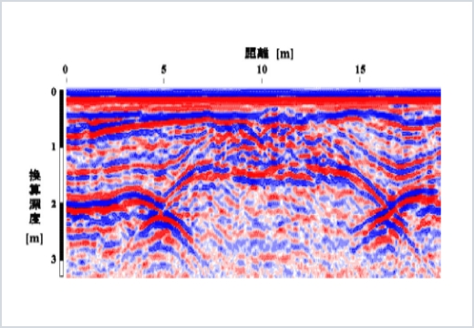
Record of cross-section for ground penetrating radar (stone burial mound)
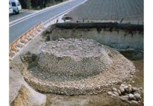
Status of excavation for stone burial mound
Onsite measurement
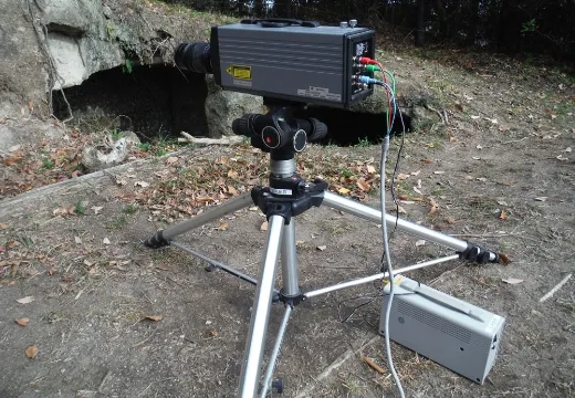
Laser doppler vibrometer
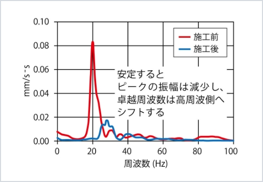
Spectrum before and after preservation work
Indoor testing
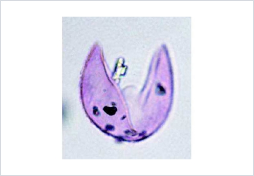
Cedar pollen fossil
Cyclic wetting and drying tests
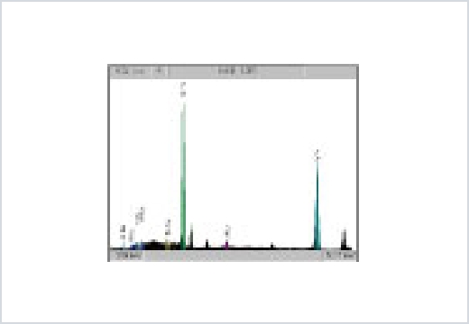
Fluorescent X-ray spectrum (composition analysis of metal relics)
Borehole survey
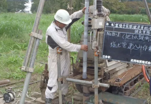
Borehole survey
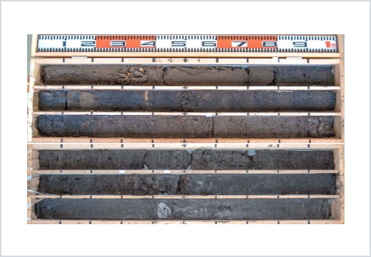
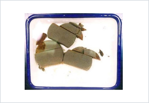
Collected undisturbed samples
Planning proposal
OYO Corporation proposes plans for preservation and utilization that utilize the characteristics of individual historic sites.
In surveys of current conditions for planning
proposals, engineers specializing in each field conduct surveys of geology and vegetation, etc., and provide comprehensive support for planning.

Work management
OYO Corporation provides preservation measures for remains, design of maintenance work for the utilization of historic sites, and consulting.
In terms of design, we will propose
the optimal construction method for protecting the remains and the landscape of the historic site, while also taking into consideration the customer's requests. For work management, we
ensure that construction progresses smoothly by supporting process coordination, the creation of order documents, etc.

Preservation of remains

Development of facilities

Countermeasures for falling rocks
Follow-up observation
Follow-up observation after completion of preservation work is important for the preservation and maintenance of remains.
In some cases, monitoring is required to propose
maintenance planning.
OYO Corporation proposes optimal monitoring for the state of remains and the local environment, from basic environmental measurements (humidity, rainfall, etc.) to soil moisture
content, groundwater level observation, stone wall displacement measurement, and more.

Preservation environment for remains

Groundwater level observation using boreholes

Weather observation for area surrounding remains

Fixed-point observation of stone walls in castle ruins

3D model of stone wall by SfM
Applicability of archaeological site exploration
1.Type of remains is unknown
Ground penetrating radar exploration is optimal in this situation. It is possible to ascertain the status of buried remains up to a depth of 1 to 2 meters. This technology has the best resolution, so it can be applied to any remains.
2.Burial mound
Ground penetrating radar exploration is optimal in this situation. Exploring burial mounds enables us to ascertain not only the buried objects, but also the shape of the burial mound, the presence or absence of surrounding grooves and fuki-ishi (stones covering a mound), and the presence or absence of metal relics.
3.Shell mounds and paving stones
Electrical exploration (mapping) is suitable for investigating the planar distribution range. Electrical exploration displays differences in specific resistance (ease / difficulty of passage of electricity). We also use ground penetrating radar exploration in conjunction when it is necessary to grasp localized distribution.
4.Ruins of castle moat
Electrical exploration (resistivity image profiling) is suitable for ascertaining cross-sectional shapes. We can also obtain the resistivity distribution (resistivity cross-section) in the depth direction at a specific position (measurement line). This technology is used to ascertain large-scale structures that cannot be ascertained by ground penetrating radar exploration.
5.Kiln ruins
Magnetic exploration is suitable for investigating the presence or absence of kiln sites. Magnetic anomaly points are extracted from the results of measuring the survey range with a
1-meter mesh.
We also use ground penetrating radar exploration in conjunction to ascertain location in detail.
6.Metal relics
Electromagnetic exploration is suitable for investigating the presence or absence of metal relics. Strong electromagnetic induction responses are extracted from the results of
measuring the survey range with a 1-meter mesh.
We also use ground penetrating radar exploration in conjunction to ascertain location in detail.